
Rognlivatnet
Rognlivatnet
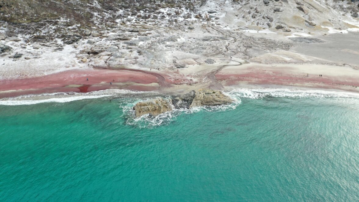
During the journey around Rognlivatn, you step into a place of local historical significance. The first iron mining site in Northern Norway was discovered near Rognlivatnet. Archaeologists have dated it back to the 13th century. Several pits contain remnants of charcoal that were used for both iron production and blacksmithing.


Hike Description
This is an easy and pleasant hike through varied terrain. If you’re driving from Bodø past Saltstraumen, turn left at Tuv onto county road 812 towards Misvær. After 35 km, you’ll reach Misvær. One kilometer south of Misvær center, on the road towards Rognan and Beiarn, turn left into a quarry where a toll road continues uphill for about 3.5 km. Park at the sign that says “parking on the left side.” The round trip is marked from the parking area.
Along the way, you can find red sludge in the streambed, indicating the potential for finding bog iron ore. Discoveries suggest that there was significant activity up here at Rognlivatnet in the early Middle Ages. At the outlet of the lake, you’ll find the remains of a dam for the Oppegaarden power station, which began operating in 1924.
The trip is one of Salten Friluftsråds selected 55 attractive hikes in the region.
Getting to Rognlivatnet
If you want to use public transportation, you can take a bus from Bodø city center to Misvær skole bus stop. There are several daily departures, and the journey takes about 1.4 hours. It’s approximately a 3-kilometer walk from the bus stop to the starting point of the trail.
Yes, you can bring your bicycle for free on the bus if you want to cycle from the bus stop to the starting point of the trail.
Hikes nearby


Was this helpful?
Thank you for your feedback!
Thank you for your feedback!
We are reading all feedback, but unfortunately we can not respond.