
Glomfjellet in Láhko National park
Glomfjellet
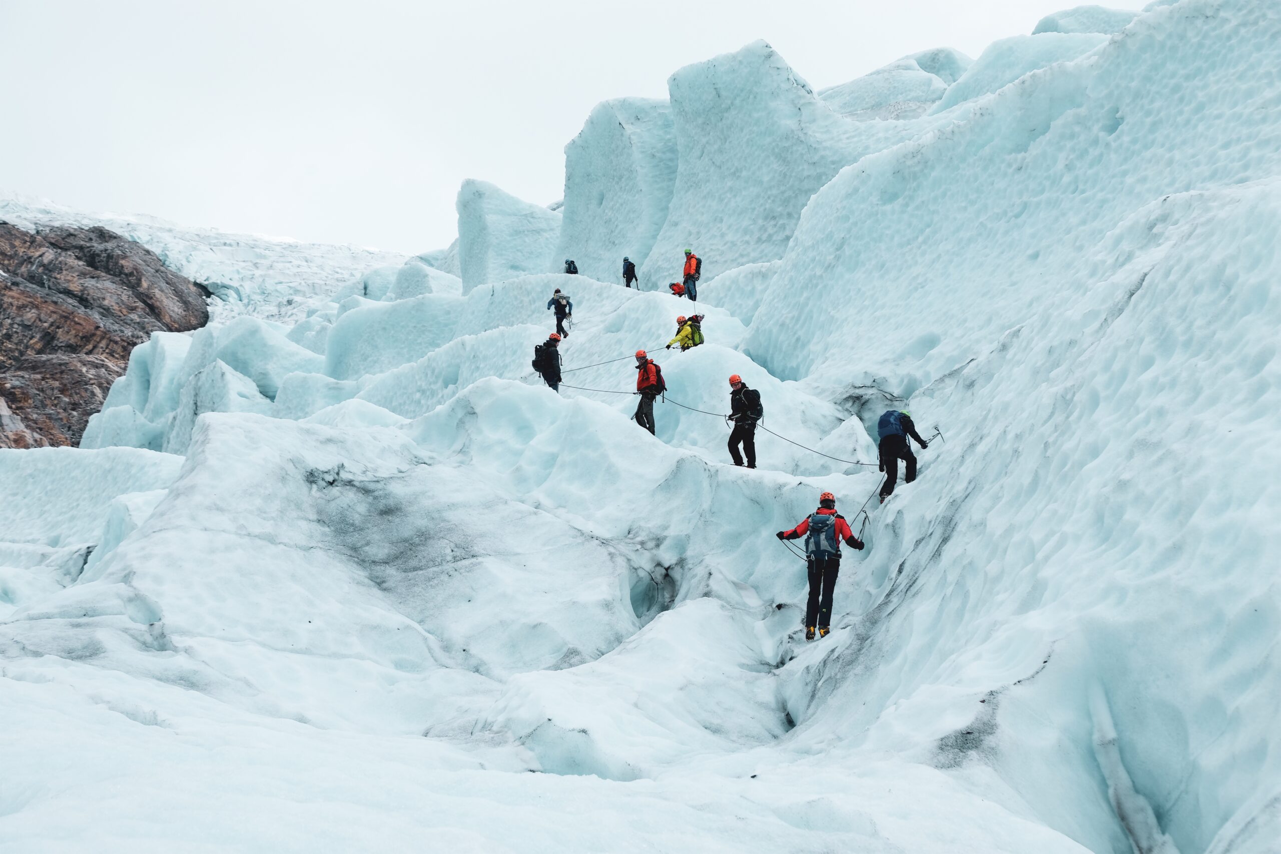
Glomfjellet is the largest continuous limestone area in Norway, above the forest border. With its size and location, the area is a unique karst landscape, even on a European scale. Here, rain and surface water have eroded the bedrock and formed a number of caves and rock formations – among the most popular are Corbels Canyon and Corbelsbrua.


Hike Description
Glomfjellet is the local name for the mountain areas east of Glomfjord, in the border areas between Gildeskål, Beiarn and Meløy. Glomfjellet is among the most popular hiking areas in the district and in 2012 large parts of this mountain were protected as a national park.
For many, the goal of the trip is to visit Corbel’s canyon and Corbel bridge. Check out #corbelscanyon and #corbelbrua on Instagram and you’ll understand why! The signposted T-trail runs here from the car park at Navnlaushøgda. Follow the path for approx. 1.1 km before you turn north and follow the path that runs between Sandvann and Namnløsvann, towards Fiskvasskardet. From here you follow the path on the north side of Svalvatn for approximately 3.5 km to the destination.
The flora in the mountain area is very rich, with more than 260 known plants. In recent years, several new discoveries of rare mountain plants have been made, including Greenland star, snow wall and tinderrub flower.
Things to do nearby
Getting to Glomfjellet
The easiest access to Láhko National Park is via construction road from Fykan deep in the Glomfjorden. The exit here is between Svartistunnelen and Fykantunnelen on Kystriksvegen / Fv. 17 (just north of Svartistunnelen). At the end of the mountain road, you come to the enormous Storglomvassdam, which is the world’s largest stone-filled dam (the dam holds an incredible 3.5 billion cubic meters of water and is equivalent to about 500 liters of water each for all the inhabitants of the earth). Here you will find parking on Navnlaushøgda.
Fra parkeringsplassen går T-merkede stier østover mot Beiarn og Saltfjellet, og nordover til Langvatnet i Gildeskål. Sommerstid er det kjørbar bilvei til Sundsfjorden og Fv 17.
During the winter, you must park in the first tunnel on the mountain road, or just above the tunnel if the car park is cleared of snow.
Glomfjellet also offers a nice hunting ground and several good fishing lakes. You buy a hunting and fishing license for state land.
Hikes and Activities nearby

Was this helpful?
Thank you for your feedback!
Thank you for your feedback!
We are reading all feedback, but unfortunately we can not respond.